All topics

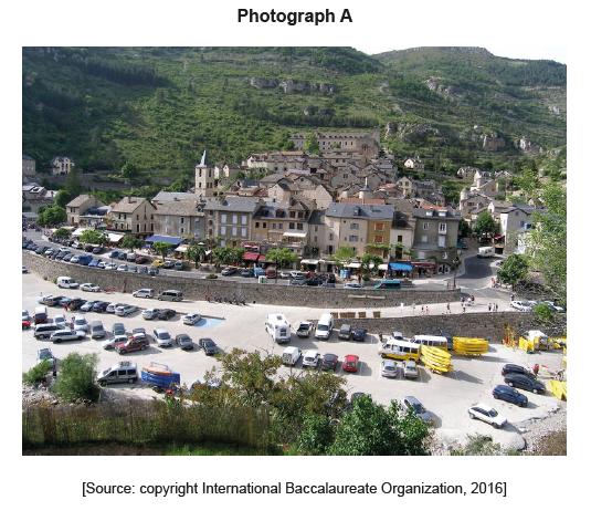
The map shows the area around the valley of the River Tarn and the town of Sainte-Enimie in Southern France. The scale is 1:100 000 and the contour interval is 40 metres. Photograph A shows the town of Sainte-Enimie.
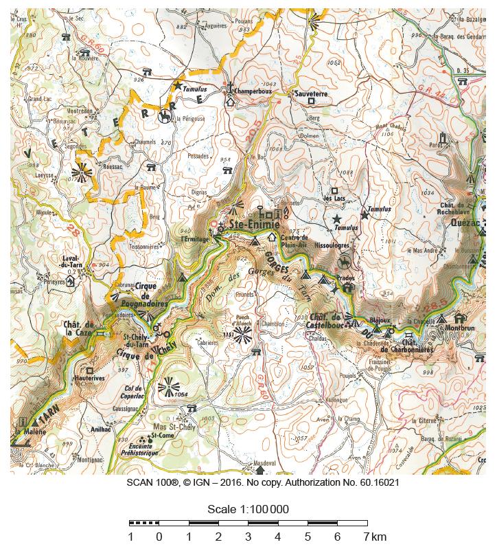

Using map evidence, identify and locate two secondary tourist resources.

Describe how one characteristic of the valley of the River Tarn limits its environmental carrying capacity.

(i) State the direction in which the camera was pointing when photograph A was taken.
(ii) Referring to photograph A, suggest the evidence that the perceptual carrying capacity of Sainte-Enimie may already have been exceeded.

Using examples, evaluate the use of tourism as a development strategy in some low-income countries.
